‘Paula Scher: MAPS’
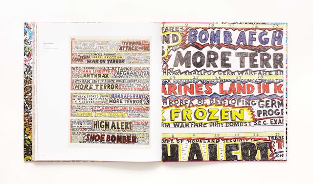
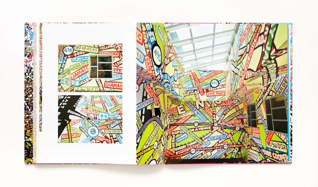
In the 1990s, Paula Scher began painting colorful typographic maps of the world, its continents, countries, islands, oceans, cities, streets and neighborhoods. The paintings are collected for the first time in Paula Scher: Maps.
MAPS presents 39 paintings, drawings, prints and environmental installations, including Scher’s commission for New York City’s Queens Metropolitan Campus. Many of Scher’s original paintings are huge—as tall as 12 feet—and the book reproduces the works in full and in life-size details that reveal layers of hand-painted place names, information and cultural commentary. The book’s jacket folds out into a 3’ by 2’ poster of a portion of World Trade, a painting from 2010.
The book opens with an essay by Scher about the influence of her father, a photogrammetic engineer who worked on aerial photography for the U.S. Geological Service in the 1950s and taught her that maps were never totally accurate. (The essay’s title: “All Maps Lie.”) Scher's father invented a measuring device called Stereo Templates that corrected lens distortions when aerial photography was enlarged for printed maps. Simon Winchester, author of The Map That Changed the World, contributes the book’s foreword, about the charm of maps in the age of GPS.


